Innovative insurance service for farmers based on satellite data gets commercial follow up in Uganda
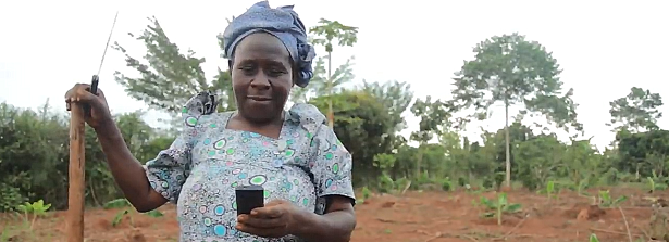
Smallholder farmers in Uganda are increasingly vulnerable to risks associated with changing weather patterns. The SUM-Africa project, supported by the G4AW program of Netherlands Space Office (NSO), provides satellite based drought index insurance to protect these smallholders. This week the Ugandan Agro Insurance Consortium (AIC) and the Dutch company EARS signed a long-term contract to continue the delivery of this service. The AIC provides the insurance and EARS, lead partner in the SUM-Africa project, provides the satellite-based drought index.
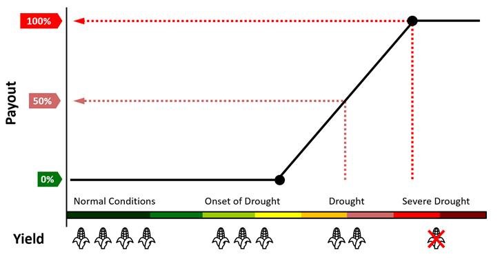
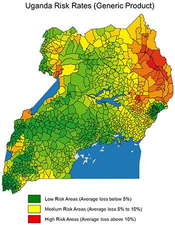 Agricultural index insurance products are linked to an index, such as temperature, rainfall, crop yield or evapotranspiration, rather than actual loss. Daily information from satellites, enables independent and continuous monitoring of climatic conditions for crop growth. This information is used by insurance companies for risk assessment, insurance pricing, and for pay-out calculation. Because insurance companies no longer need to visit the farmer to assess their loss and determine payout, transaction costs are much lower. Insured farmers are more likely to get a loan, enabling them to invest in improved input that boost their resilience to climate change and increase their food production and income.
The Sum-Africa consortium consisting of eight African and Dutch partners, now rolls into its fifth year and starts operating on a commercial basis. An increasing number of farmers are being insured, with some 75,000 farmers insured in 2018. Sales numbers are expected to double over the next 2 years.
This is possible with AIC continuing to reach out and insure new farmers. AIC Technical Manager Munyaradz: “The secret to success in providing microinsurance products is minimizing the costs of the product offering together with the right product design. With G4AW support we have been able to access the right products from EARS and with our combined efforts we have proven the viability of Agricultural insurance in Uganda. From here we will continue to improve our services and to grow in scale.” At the same time EARS takes care for rapid and independent monitoring and loss detection via satellites. Joost van der Woerd, SUM-Africa Project Coordinator, explains: “Satellite tech is only part of the story. Our success so far is based on local actors -AIC foremost- with understanding of Ugandan realities and access to the right players in the agri-market”.
An important contribution is made by the Ugandan government in the form of a premium subsidy. Government support underlines the advantages of agricultural insurance. It shows trust in satellite technology to provide reliable and scalable solutions, ultimately to benefit large numbers of smallholders across Uganda. EARS and partners continue to provide innovative insurance solutions for more ‘Climate smart agriculture’ across Africa.
SUM-Africa is part of the Geodata for Agriculture and Water (G4AW) program, which aims to improve food security in developing countries by using satellite data. The Netherlands Space Office (NSO) carries out this program on behalf of the Ministry of Foreign Affairs. The G4AW programme enabled the SUM-Africa partnership to develop a sustainable business model. It is one of 23 G4AW projects in 14 countries aiming to boost climate resilience of agricultural production systems in Africa and Asia. Adri Bakker, NSO Advisor Applications:“Use of satellite based information provides low cost index based insurance services, efficient and at the same time viable for all stakeholders involved. SUM-Africa is a good example of a G4AW project that leads to a sustainable business case.”
For more information on the SUM-Africa project, please visit the G4AW website.
Watch the video about how satellite applications improve food security in Uganda:
_ _ _
Article Source: Netherlands Space Office


Soil fertility and health care in order to improve the farmers production and environmental protection