Ground cover app to drive an irrigation scheduling service in the delta region of Bangladesh
Duration: January 2016 – January 2019. This project has been finalized.
Project information
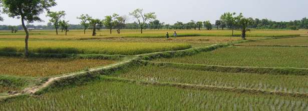
Aim: Large tracts of land in the delta region of Bangladesh are left fallow or are cultivated with low input crops during the dry winter months. Surface water based irrigation opens up new opportunities for sustainable intensification by enabling the production of a high yielding crop. To ensure an optimal use of irrigation pumps, CIMMYT (International Maize and Wheat Improvement Center) is currently developing an advisory system for irrigation scheduling, which calculates a daily soil water balance and estimates crop water use based on ground cover derived from satellite data. The project aims to replace satellite data by RGB photos taken with smartphones as these do not depend on weather conditions and are accessible to famers.
Objective: The overall objective of the proposed project is to optimize water resource management by enabling farmers to obtain field-specific irrigation advice, which when mobilized, will in turn will increase food production and food security. Use of intensive, cost-effective irrigation that boosts yield will also generate more cash income for farm households, as a higher share of farm produce can be sold on the market. Business opportunities for ISPs will also increase. Our specific objectives are:
- Develop an app that enables farmers to capture field specific ground cover photos with an off-the-shelve smart phone.
- Automatically analyse the RGB photos and estimate percent ground cover.
- Transmit ground cover estimates to a server where they will be integrated into the irrigation advisory system in order to schedule irrigation requirements in real time.
- Integrate the ground cover estimates into the irrigation advisory system.
- Ensure that women and illiterate farmers are included in the training and will get access to the technology and enable them to potentially use the phones for other applications.
- Determine what the best design for a user friendly app is, so that there are no barriers to access.
Method: The project will not only focus on a thorough validation and calibration of the new system, but ensure proper training of potential users, including women and illiterate farmers.
Country: Bangladesh.
Dutch policy goals: Increased sustainable agricultural production; and Improved access to better nutrition.
Progress report
Year 1: This project aims at developing a smartphone app that estimates the percent of ground covered by green leaves when seen from above. PANI, an irrigation scheduling app, uses this input to determine crop water use. In the first year, CIMMYT collected and analysed ground cover photos taken from several crops and with different smart phones. ITC then developed and tested various algorithms to automatically estimate the percent ground cover from these photos. BIID is now working on the creation of the app and on the integration of the ground cover algorithm into PANI. First field tests of the app were conducted. Users faced some challenges when determining the quality of the photos in the field under bright sun light. BIID is therefore changing the interface of the app. We are now asking farmers to take 15 photos from a field, in order to minimize errors.
Final report
Summary of the results: Ground cover is the percentage of ground covered by green vegetation when seen from above. It is a measure of the amount of light a crop can intercept for photosynthesis. It also is an indicator of the health and nutrient status of a crop. Research has also shown that it is linearly related to crop water use. This project aimed at developing a smartphone app that estimates ground cover from RGB photos. PANI, an irrigation scheduling app, uses this input to determine crop water use. CIMMYT collected and analysed ground cover photos taken from several crops with different low cost smart phones. ITC then developed and tested various machine learning algorithms to automatically estimate ground cover from these photos. BIID integrated the ground cover algorithm into the PANI app and also programmed a standalone version. Several field tests of the app were conducted during which the farmers, who are the end users, and thus direct beneficiaries, received training. We used their feedback to improve the app. The tests also included female and young farmers, who were eager to use “cool” technology. The farmers are looking forward to using PANI as it will help them save water by irrigating crops at the right time and thus increase income and food security.