Home /

satellite data

Share:
March 7, 2017Knowledge Portal
Monitoring rice agriculture across Myanmar using satellite data

This article in the Remote Sensing Journal highlights new opportunities for monitoring agriculture. Assessment and monitoring of rice agriculture over large areas has been limited by cloud cover, optical sensor spatial and temporal resolutions, and lack of systematic or open access radar. The use of dense time series of open access Sentinel-1 C-band data at moderate spatial resolution offers innovative opportunities for assessment and monitoring of agriculture. »

Geodata and ICT Solutions for Inclusive Finance and Food Security
February 27, 2017Knowledge activity
Geodata and ICT Solutions for Inclusive Finance and Food Security

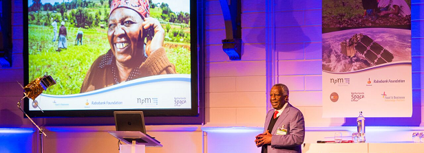
On February 16, NpM, Rabobank Foundation and NSO organized the conference “Geodata for Inclusive Finance and Food”. The conference aimed to show, share and discuss the latest technological applications based on satellite data in relation to inclusive finance and food security. »

Sixteenth F&BKP newsletter
November 25, 2016News
Sixteenth F&BKP newsletter

The November newsletter of the Food & Business Knowledge Platform (F&BKP) is filled with nine updates on F&BKP related research, calls and events.  On the F&BKP website a Partners section has been published with information on strategic partnerships and a non-exhaustive, dynamic and continuously growing overview of partners of the Platform. Information on the collaboration and knowledge »

Lessons learned in the first years of the Geodata for Agriculture and Water (G4AW) Facility
November 24, 2016News
Lessons learned in the first years of the Geodata for Agriculture and Water (G4AW) Facility

The F&BKP assisted with a mid-term review of the Geodata for Agriculture and Water (G4AW) Facility. The findings show that the G4AW Facility opens new markets for providing information services. The G4AW projects offer a wide range of business models that address a gap in the current global geodata services market by offering locally targeted advice to small food producers, based on satellite information. »

Geodata for Agriculture and Water - improving food security
October 22, 2014News
Geodata for Agriculture and Water – improving food security

Geodata for Agriculture and Water (G4AW) improves food security in developing countries by using satellite data. Netherlands Space Office (NSO) is executing this programme, commissioned by the Dutch Ministry of Foreign Affairs, and a second call for proposals has been released in September 2014. The Geodata for Agriculture and Water (G4AW) programme was started in »